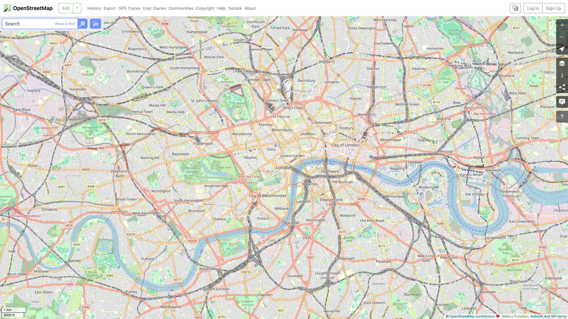
OpenStreetMap (OSM) is a collaborative project to build a free, editable map of the world: roads, trails, cafés, railway stations, and much more are surveyed and maintained by a global community of contributors, and the resulting database is published under the Open Database License (ODbL). Anyone may copy, distribute, and adapt the data — including commercially — as long as they credit OpenStreetMap and its contributors. Unlike Google Maps and similar commercial services, OSM's core product is the data itself rather than a closed map service: you can download the entire planet and render or query it on your own infrastructure. openstreetmap.org is the project's official home, serving both as a reference map and as the main entry point for contributing and downloading data.
At a Glance
- URL: https://www.openstreetmap.org/
- Type: Open geodata collaboration project + online map
- Cost: Browsing the map and using the data are free, with no ads; infrastructure runs on donations and sponsorships (the About page notes hosting is supported by Fastly, OSMF corporate members, and other partners)
- Sign-up: Browsing, search, and routing need no account; editing the map requires a free account (the Terms of Use set a minimum age of 13); sign-in supports third-party identity via Google, Apple, Facebook, Microsoft, GitHub, and Wikipedia (observed on the login page on 2026-08-30)
- Interface languages: 100+, including English, Simplified and Traditional Chinese (as of 2026-08-30, the website's source repository contains 114 locale files under
config/locales)
Background
Steve Coast founded OpenStreetMap in 2004 while at University College London, frustrated that government-collected UK mapping data was not freely available. The domain was registered on 9 August 2004, and the first street was entered that December. The OpenStreetMap Foundation (OSMF) was established in August 2006 and now formally operates the site and related services on behalf of the community. On 12 September 2012 the project moved its data license from CC BY-SA to the database-oriented ODbL. These milestones are documented on the project history page of the official wiki.
On scale, the official database statistics page (report generated 2026-08-30 00:00 UTC) reports 10,788,471 registered users, roughly 10.83 billion nodes, 1.21 billion ways, 14.7 million relations, and 32.07 billion uploaded GPS points. Registered accounts are not the same as active mappers, though: the summary on the wiki statistics page puts the number of distinct contributors who have actually edited data at about 2.25 million (as of Q2 2025).
The project is open source end to end: the Rails application behind the website is published on GitHub under GPL-2.0 with roughly 2,800 stars as of 2026-08-30 and commits as recent as 2026-08-28; the iD editor, the Nominatim search engine, and the rest of the core toolchain are open source as well.
What You Can Do on the Site
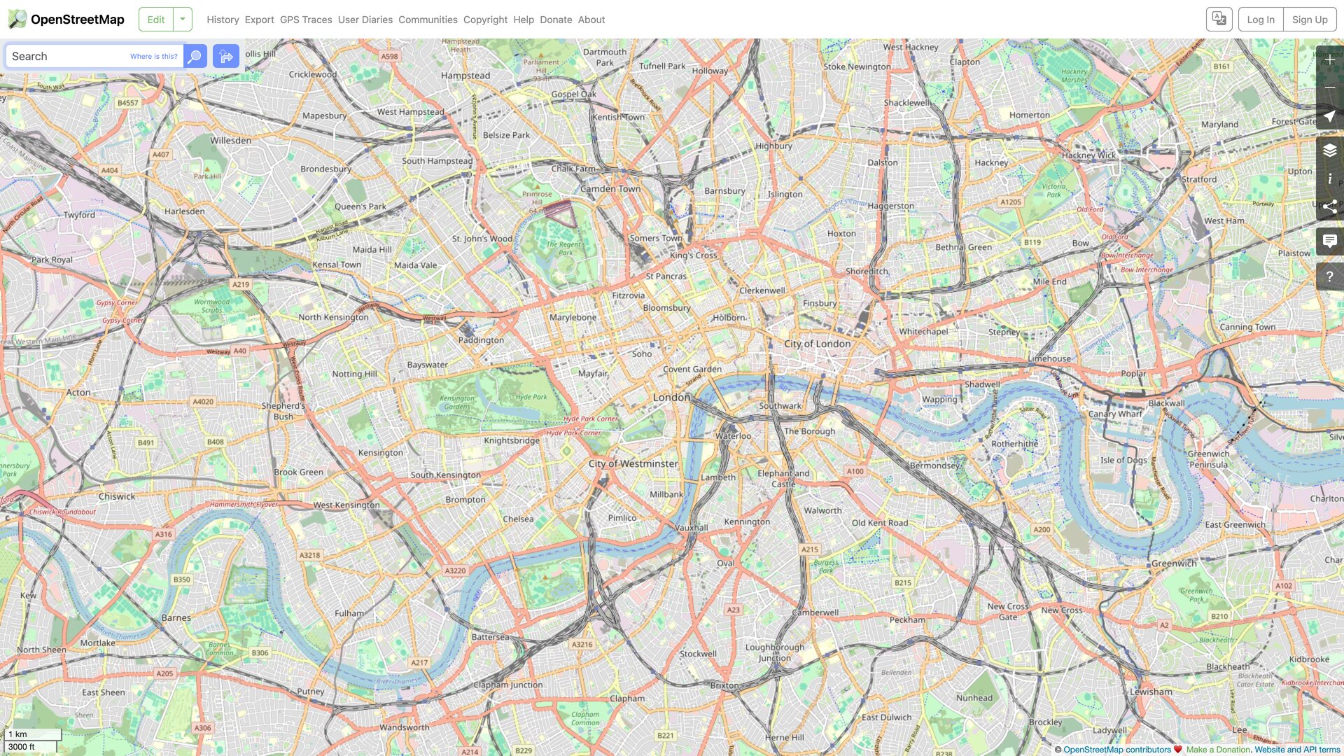
- Browse the map: the default "Standard" layer (OpenStreetMap Carto style), plus switchable layers such as Cycle Map, Transport Map, and the Humanitarian style, some of which are operated by third parties (see the third-party services list in the Privacy Policy).
- Search: place names, addresses, and points of interest, powered by the Nominatim engine, which also supports reverse geocoding.
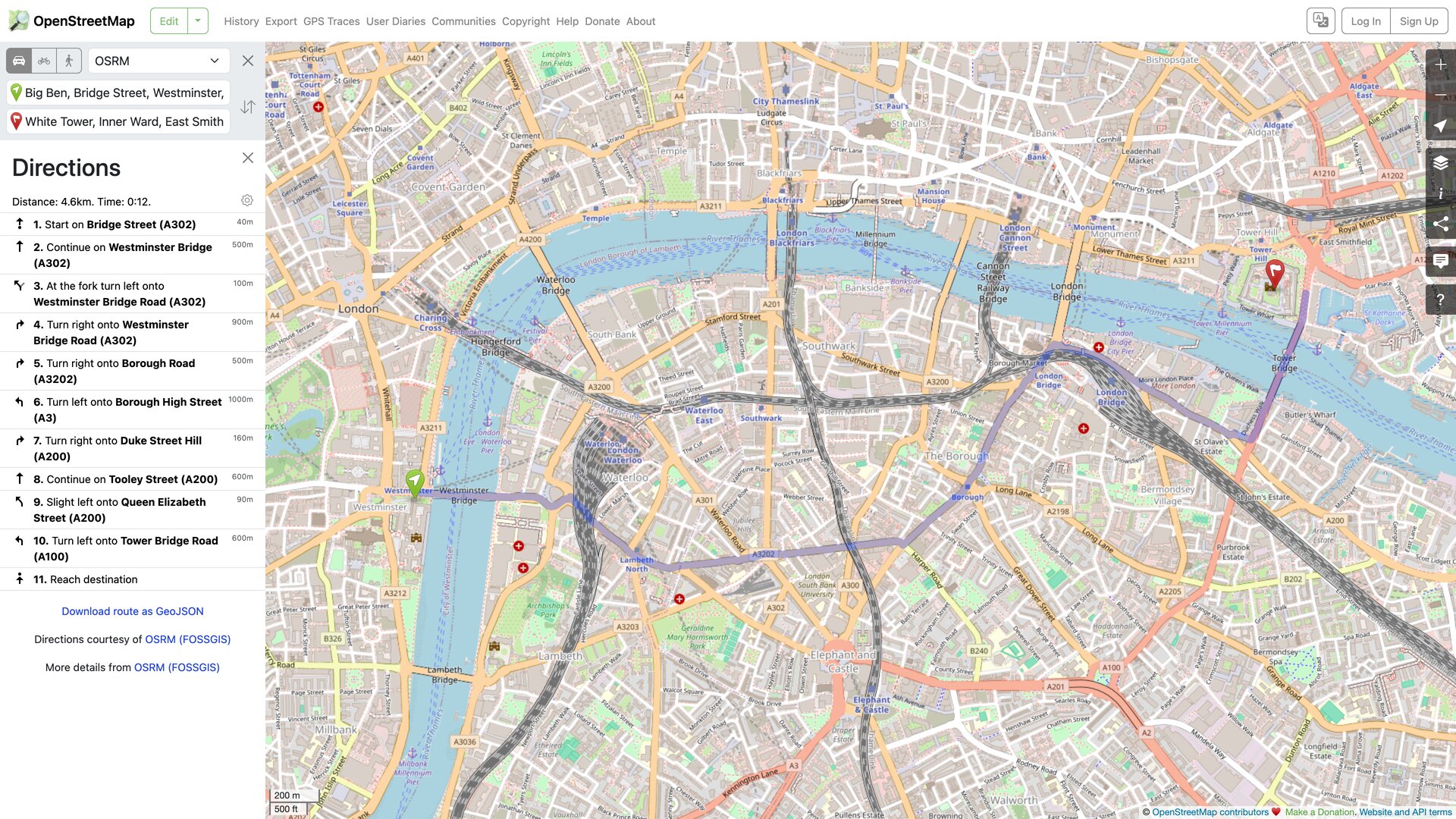
- Get directions: point-to-point routing for driving, walking, and cycling, computed by third-party engines such as OSRM operated by FOSSGIS. Results include turn-by-turn instructions with distance and time estimates and can be downloaded as GeoJSON. Below is a live route from Big Ben to the Tower of London:
- Inspect the data: every object carries a full revision history grouped into changesets, viewable through the built-in data browser and the "query features" tool (backed by the Overpass API).
- Leave notes: without an account, anyone can drop a note on the map to flag a problem for other mappers to verify (available since 2013, per the project history).
- Share and embed: the share panel generates short links to the current view and a ready-to-paste iframe snippet for embedding the map in a web page (tested on 2026-08-30).
- GPS traces: registered users can upload GPX traces as editing references, either public or as anonymized points.
Accounts and Open Access
Reading is wide open; editing is not — the project deliberately does not support anonymous edits so that contributions stay attributable and vandalism can be managed. A free account unlocks the default in-browser iD editor (the default since 2013) as well as desktop editors such as JOSM.
For developers, OSM's openness comes in layers, each governed by an official usage policy:
- Bulk data: planet.osm publishes full-planet snapshots plus minutely diffs, and many third parties offer regional extracts. This is the canonical way to get the data.
- Editing API:
api.openstreetmap.orgexists primarily for editors submitting changes. The API usage policy states it is not a read-only data endpoint — downloads are limited to two threads, and read-only querying belongs on the community-run Overpass API. - Nominatim public API: the policy caps usage at one request per second, forbids autocomplete-style calls and systematic bulk geocoding, and requires client-side caching of results. Heavier needs should run on a self-hosted instance or a paid provider.
- Map tiles: the standard raster tiles at
tile.openstreetmap.orgare free to use, but the tile usage policy requires visible attribution, an identifying User-Agent, honoring HTTP cache headers (at least 7 days), and bans bulk scraping and offline prefetching. There is no SLA, and access can be blocked without notice; the vector tiles atvector.openstreetmap.orghave their own policy. For production traffic, the expected paths are self-hosting per switch2osm.org or using a commercial OSM provider.
Copyright and Content Policy
- Data license: the map data is under the ODbL. Using it requires the credit "© OpenStreetMap contributors" and a note that the data is under the ODbL. If you build a derived database and make it publicly available, you must share it under the same license; merely publishing rendered "produced works" (such as map images) only requires attribution. Site documentation is under CC BY-SA 2.0.
- Content rules: contributors must never copy from copyrighted sources such as Google Maps or printed maps, and suspected infringements can be reported through the official takedown procedure. Some national mapping agencies' open data (e.g., Great Britain's Ordnance Survey, Finland's National Land Survey) is legally incorporated under licenses such as CC BY, as listed on the copyright page.
- Trademarks: the OpenStreetMap name and the magnifying-glass logo are registered trademarks of the OSMF.
- Privacy: every edit is publicly recorded with the username and timestamp — that traceability is part of data governance. Registered email addresses are never published, and GPS trace uploads are optional. When an account is deleted, its name is rewritten to
user_USERIDwhile contributions remain (see the Privacy Policy).
Who It's For
- Developers, researchers, and data journalists who need map data they can freely use, modify, and redistribute.
- Websites and apps that want map capabilities without commercial map API quotas and billing — provided they serve the data from their own infrastructure or a commercial OSM provider.
- Humanitarian and civic work: volunteers rapidly map disaster-affected areas, and OSM underpins efforts like the Humanitarian OpenStreetMap Team.
- Local businesses and community groups that want their shops and facilities correctly represented in a widely reused public map.
- Teaching and GIS learning: real-world data, an open schema, and a fully self-hostable toolchain.
Limitations
- Uneven coverage and accuracy: data quality tracks the activity of local mapping communities and varies noticeably between countries and between urban and rural areas. The Terms of Use state that the OSMF cannot review every edit and does not guarantee accuracy — safety-critical or navigation-grade use cases need independent verification.
- Official services are not production backends: tiles, Nominatim, and the editing API run on donated capacity. Policies reserve the right to block traffic without notice, so building a commercial product directly on these free endpoints is risky.
- The main site is not a consumer navigation product: there is no live traffic, and the OSMF ships no official mobile navigation app — the phone experience comes from third-party apps such as OsmAnd and Organic Maps.
- ODbL share-alike takes legal care: merging OSM data with proprietary data into a publicly offered database can trigger the share-alike clause; commercial products should read the licensing guidance first.
- Contributing is public by design: edit histories stay visible under your username indefinitely, so pick a username that doesn't expose more than you intend.
Alternatives and Ecosystem
- Google Maps / Apple Maps: polished consumer experiences with consistent data quality, but closed data, metered APIs, and no right to download or redistribute.
- HERE / TomTom: commercial geodata vendors — the opposite licensing model from OSM's open approach.
- Mapbox, MapTiler, and similar providers: commercial hosting built partly on OSM data; the common choice when you don't want to self-host.
- OsmAnd, Organic Maps: consumer mobile apps built on OSM data that fill the offline-navigation gap the main site leaves open.
References
- OpenStreetMap About page
- OpenStreetMap Copyright and License page
- OSMF Terms of Use
- OSMF Privacy Policy
- Official database statistics (report of 2026-08-30)
- OSM wiki: Stats
- OSM wiki: History of OpenStreetMap
- Tile Usage Policy
- API Usage Policy
- Nominatim Usage Policy
- GitHub: openstreetmap-website (site source, GPL-2.0)
(All pages checked on 2026-08-30; routing, iframe embedding, and third-party sign-in options were verified hands-on on the live site the same day.)