MarineTraffic is a global vessel tracking platform built on AIS (Automatic Identification System): open the live map and you can watch ships move in near real time, then click any vessel to pull up its IMO number, dimensions, gross tonnage and build details. Its core job is making maritime traffic visible — whether you want to know if a freighter has reached port or how busy a strait is. What sets it apart from similar services is a hybrid data model: a volunteer community of coastal AIS receivers combined with commercial satellite AIS, in what the company calls "the first and largest AIS network in the world" (over 13,000 AIS receivers as of 2026-09-02). The platform began as an academic project at Greece's University of the Aegean in 2007 and has belonged to Belgian data firm Kpler since 2023.
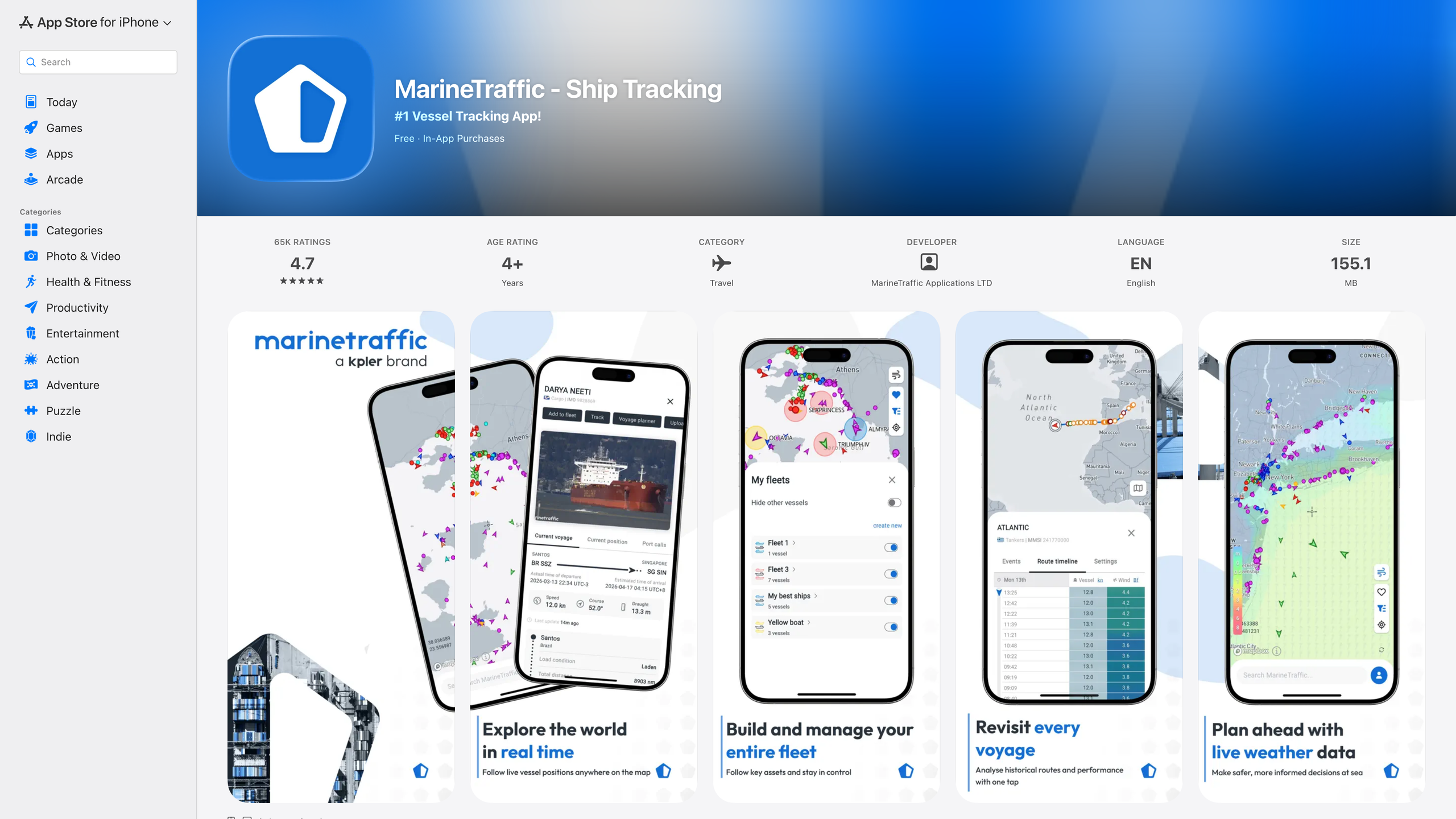
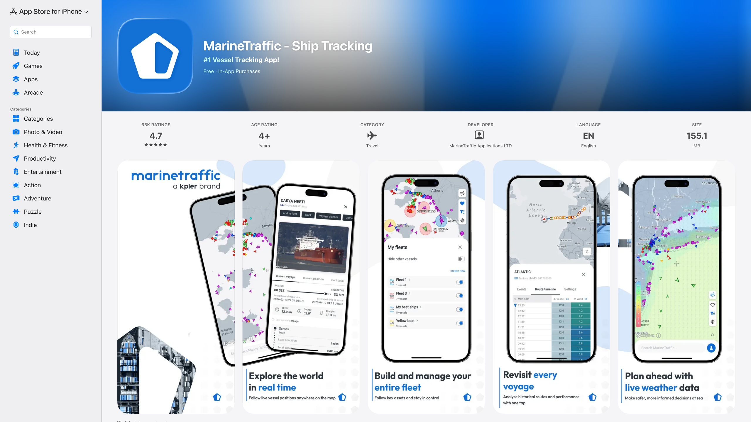
The image above is MarineTraffic's official App Store page (as of 2026-09-02: app version 5.8.4, about 65,000 ratings averaging 4.7 on the US storefront, free with in-app purchases; source: Apple iTunes Lookup). The screenshot carousel shows the official mobile app's live vessel map, "My Fleets" management, per-vessel voyage timelines and weather data. Because marinetraffic.com strictly blocks automated access, the illustrations in this article come from its official app store listing, its official open-source repository and its parent company's product page, all checked on the same date.
At a glance
- URL: https://www.marinetraffic.com/
- Type: AIS vessel tracking and maritime data platform (with UGC such as community photos)
- Cost: Core features free; paid subscriptions in three tiers — Basic, Essential and Enterprise (details below)
- Registration: Not required for the live map; a free account unlocks vessel search, custom fleets and more
- Interface languages: 11, including English, Chinese, Spanish, Arabic, Russian, German, French, Greek, Norwegian, Dutch and Portuguese (source: Wikipedia)
- Launched: Trial version published in late 2007
- Operator: MarineTraffic (headquartered in Athens, Greece); parent company Kpler Holding SA, Belgium
Background
MarineTraffic started as an academic project at the University of the Aegean in Ermoupoli, Greece, and was published as a trial version in late 2007 by Professor Dimitris Lekkas. Coverage grew through AIS receivers volunteered by radio enthusiasts, and the project eventually became a commercial company headquartered in Athens. (Source: Wikipedia)
On 15 February 2023, Kpler — a Brussels-based commodity data and analytics company founded in 2014 — announced the acquisition of both MarineTraffic and the German vessel tracker FleetMon, which MarineTraffic had itself acquired earlier, making it a coordinated double deal. The two acquisitions closed on 7 and 13 March 2023 respectively. According to Kpler's press release, the company had raised over $200 million from Five Arrows and Insight Partners in 2022 and, after the deals, employed more than 500 people serving over a million active users.
Where the data comes from: AIS and a global receiver network
AIS is the system ships use to automatically broadcast their position, course, speed and identity. Under IMO SOLAS regulation V/19, AIS is mandatory on all ships of 300 gross tonnage and upwards on international voyages, cargo ships of 500 gross tonnage and upwards on domestic voyages, and all passenger ships regardless of size; the requirement took full effect on 31 December 2004. MarineTraffic's data foundation is exactly these broadcasts: volunteer shore stations pick up coastal traffic, while satellite AIS fills in the open ocean.
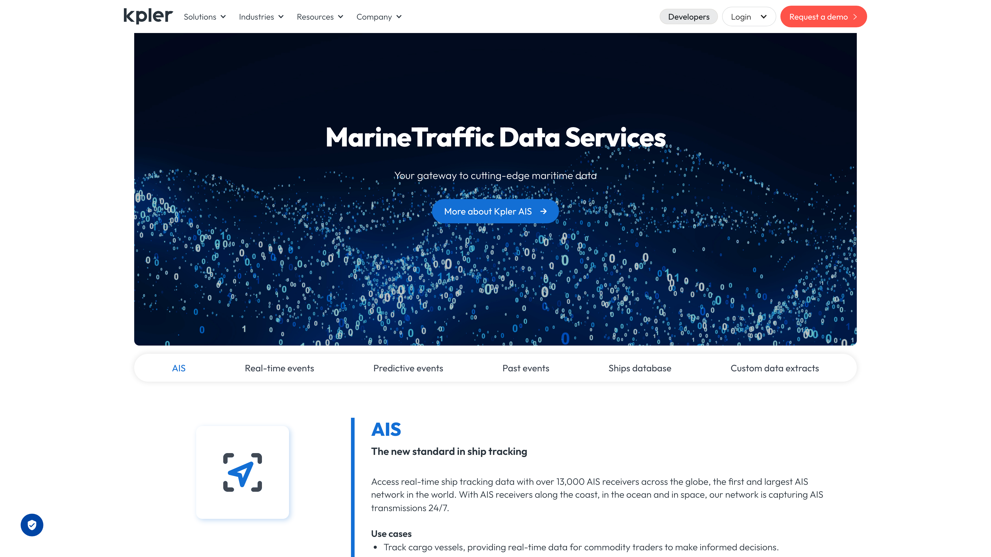
The image above shows the MarineTraffic Data Services page on parent company Kpler's website. Per the official figures (as of 2026-09-02), the network spans more than 13,000 receivers along coasts, at sea and in space, capturing AIS transmissions around the clock with an average message latency of five seconds and an AIS archive reaching back to 2010. Beyond live positions, the data products cover port and berth calls, ship-to-ship transfers, predictive ETAs and a vessel master database, accessible via API or a live NMEA stream.
Core features
- Live map: Filter vessels by type and status (underway or at anchor), click a ship for its profile and recent track; several base maps are available, and paid users can overlay nautical charts and weather layers.
- Vessel search: Registered users can search by name, IMO, MMSI, callsign, tonnage, flag or dimensions. IMO numbers are assigned by the International Maritime Organization and never change, making them a stable identifier across databases.
- Ports and calls: Port pages show arrivals and departures over the past 24 hours, vessels currently in port and expected arrivals. According to Bellingcat's toolkit entry (updated August 2026), the platform indexes roughly 550,000 vessels, over 20,000 ports and anchorages, more than 16,000 lighthouses and navigational aids, and over 50,000 maritime-related companies.
- Historical tracks and playback: Free accounts can replay about three days of a vessel's track; paid plans extend this to roughly two years and add area playback, commonly used for incident analysis and port efficiency reviews.
- Density maps and voyage planning: Historical AIS is aggregated into vessel density heat maps (the past year is free), and a voyage planner uses density patterns to help design routes.
- Mobile apps: Official apps exist for iOS and Android, plus OnCourse (formerly mAIS) for small craft, which can report your own position while underway.
Accounts, pricing and open capabilities
The live map works without an account; a free registration adds vessel search, a custom fleet of up to five vessels and notifications. Paid subscriptions come in three tiers (as recorded from the official pricing page by Bellingcat's toolkit in August 2026): Basic at US100/year, Essential at US1,000/year, and Enterprise via sales contact; add-on packs and pay-per-use credits were discontinued in January 2025. As of 2026-09-02 we could not reach the official pricing page to re-verify, so prices follow that record. Paid tiers mainly unlock satellite AIS positions, longer history, weather and chart layers, and port congestion data.
For developers, Kpler offers the MarineTraffic AIS data APIs covering live and historical positions, port events, vessel master data and predictive routes — an enterprise-grade paid service.
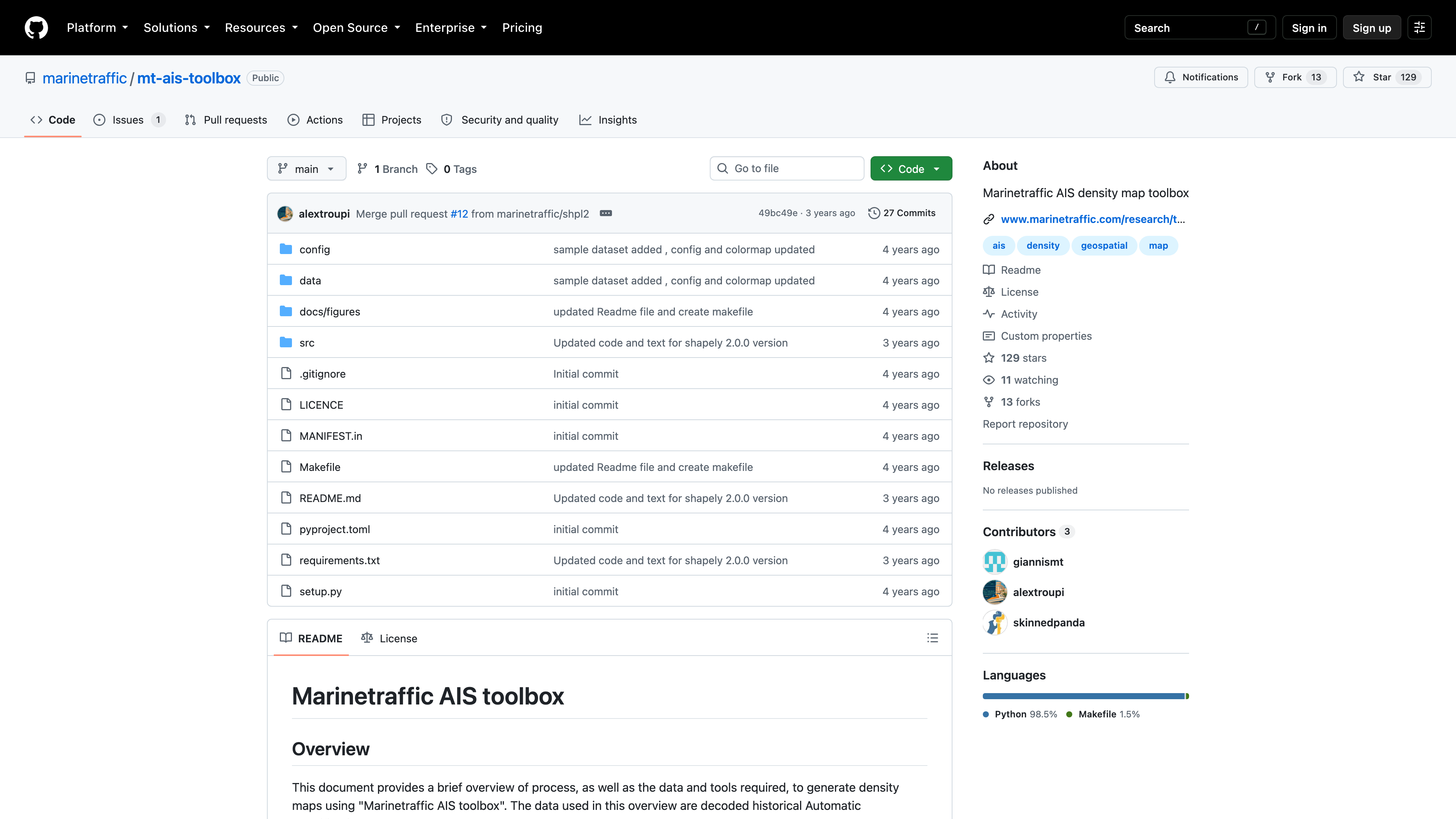
The image above shows MarineTraffic's official GitHub repository mt-ais-toolbox. Open-sourced in June 2022, this Python toolbox cleans decoded historical AIS data and generates vessel density maps. It is licensed under CC BY-NC-SA 4.0 (Attribution-NonCommercial-ShareAlike) and had 129 stars as of 2026-09-02. It also underlines the platform's academic roots: the work was part-funded by the EU's European Maritime and Fisheries Fund.
Copyright and content policy
MarineTraffic's ship photos are uploaded by a community of photographers, credited to their uploaders, and can be rated by other users (sources: Wikipedia, Panbo). Treat the photos as reference material for identifying a vessel's appearance, and check the credit and licensing status of each image before reuse.
The other kind of "content" is the AIS data itself. AIS was designed for navigational safety and its signals are broadcast openly — anyone with a receiver can pick them up — yet publishing this data at scale is contested. In December 2004, the IMO's Maritime Safety Committee adopted a position condemning the publication of ship AIS data on the web as potentially detrimental to the safety and security of ships and port facilities, urging member states to discourage it (source: IMO). That stance is part of the policy backdrop for every public vessel tracking service, MarineTraffic included.
Who it's for
- Ship enthusiasts and photographers identifying nearby vessels and browsing community photos
- Shipping, port and supply-chain professionals monitoring fleets, port calls and congestion
- Commodity and trade analysts following cargo movements, ship-to-ship transfers and trade flows
- Journalists and OSINT researchers investigating vessel tracks or sanctions evasion (Bellingcat lists it in its investigation toolkit)
- Marine and geography researchers working with density maps and historical AIS
Limitations
- AIS can be switched off: Vessels can disable or manipulate their transponders to avoid tracking ("dark shipping"), so data may be missing or misleading precisely around sanctions evasion or illegal fishing (source: Bellingcat's toolkit).
- Open-ocean coverage sits behind a paywall: Shore stations only cover coastal VHF range; once a ship leaves that range, free accounts see little more than its type and name. Satellite positions require payment, whereas some peers — Global Fishing Watch for certain use cases — provide satellite data for free.
- Key registry data is paid: Vessel dimensions, ownership and port call logs are reserved for subscribers.
- Government and naval vessels are largely absent: Such ships typically do not broadcast publicly or are not listed, so the picture is inherently incomplete.
- Privacy note: Bellingcat records that the site's cookie consent manager involves hundreds of partners; privacy-conscious readers may prefer to reject all.
Alternatives
- VesselFinder: Another AIS-based tracker whose free tier draws different lines; often used alongside MarineTraffic.
- Global Fishing Watch: A non-profit project offering fishing-vessel activity and some satellite AIS data for free, with a conservation focus.
- Flightradar24: The aviation counterpart, tracking flights in real time via ADS-B with a very similar product shape.
References
- MarineTraffic - Wikipedia (University of the Aegean origins in 2007, Dimitris Lekkas, freemium model, photo community, 11 interface languages; checked 2026-09-02)
- Kpler press release: acquisition of MarineTraffic and FleetMon (announced 2023-02-15, closed March 2023, Kpler background; checked 2026-09-02)
- MarineTraffic Data Services - Kpler (13,000+ receivers, 5-second latency, archive since 2010, API/NMEA; checked 2026-09-02)
- Kpler Maritime product page (AIS metrics; checked 2026-09-02)
- IMO: AIS carriage requirements and security position (SOLAS V/19 scope, 2004 MSC position; checked 2026-09-02)
- Bellingcat's Online Investigation Toolkit: MarineTraffic (free vs paid boundaries, pricing, indexed scale, limitations; updated August 2026, checked 2026-09-02)
- marinetraffic/mt-ais-toolbox - GitHub (AIS toolbox, CC BY-NC-SA 4.0, 129 stars; checked 2026-09-02)
- Apple iTunes Lookup: MarineTraffic - Ship Tracking (iOS app version and rating; checked 2026-09-02)
- Panbo: MarineTraffic.com, appreciating the nuances (photo community and photographer rights; checked 2026-09-02)