Flightradar24 (flightradar24.com) is a flight-tracking service operated by Flightradar24 AB of Sweden. Open the website or app and you get a live map where airborne aircraft move across it as icons; clicking one reveals its route, aircraft type, altitude, speed, and photos of the actual airframe. It answers a simple question — "what is that plane overhead, where did it come from, where is it going?" Its verifiable distinctions among trackers: it runs primarily on a crowdsourced ADS-B receiver network that the company describes as the world's largest (55,000+ receivers, as of 2026-09-02), the free tier is generous enough for everyday use, and its data has repeatedly been cited by news media during major aviation events.
At a Glance
- URL: https://www.flightradar24.com/
- Type: Live flight-tracking map (web plus iOS/Android/smartwatch apps)
- Cost: Free tier (ad-supported) plus Silver/Gold/Business subscriptions; US App Store in-app prices list Silver at 12.99/year and Gold at 34.99/year (as of 2026-09-02; prices vary by region and platform)
- Registration: Not required to view the map or flight details; a free account saves 1 bookmark, subscriptions raise the limit
- Interface language: Website is English-only; the mobile app ships in 10 languages including Simplified Chinese
(Verified by direct visit on 2026-09-02.)
Background
Flightradar24 began in 2006 as a hobby project by two Swedish aviation enthusiasts who built an ADS-B receiver network across Northern and Central Europe; in 2009 the network opened up so anyone with a receiver could feed data, and coverage expanded quickly (company description on its careers site). Its predecessor domains were Flygbilligt.com and later Flygradar.nu (Wikipedia). The company is headquartered in Stockholm and reported revenue of SEK 418.8 million in 2024 (Swedish company registry data, cited via Wikipedia).
Per the company's 2026 careers-page figures: over 55,000 connected receivers, more than 5 million users per day, 100+ million app downloads, and 50+ million monthly visits; the subscription page additionally claims over 1 million paying subscribers. In 2015 Flightradar24 acquired the aviation photo library JetPhotos, which supplies the aircraft photos shown on the map (Wikipedia).
The service has repeatedly been a data source for news coverage: international media used it to depict the airspace shutdown during the 2010 Eyjafjallajökull eruption, and again during the MH370 disappearance and MH17 downing in 2014. In August 2022, more than 708,000 people simultaneously tracked SPAR19 carrying Nancy Pelosi as it landed in Taipei — then the most-tracked flight ever (Flightradar24 blog, summarized via Wikipedia); the following month, the flight carrying Queen Elizabeth II's coffin set a new record with 4.79 million trackers.
Where the Data Comes From
Per the official How it works page (checked against a February 2026 archive), the platform fuses several sources, then layers airline and airport schedule and status data on top:
- ADS-B: the primary source. Aircraft transponders broadcast position and other data, picked up by ground receivers; the company claims a network of over 50,000 ground receivers, each covering roughly 250–450 km, which makes oceanic coverage impractical from the ground;
- MLAT (multilateration): in receiver-dense regions, four or more receivers measure signal time-difference-of-arrival to locate older Mode S aircraft without ADS-B;
- Satellite ADS-B: space-based receivers from multiple providers fill in oceans and remote areas (opened to all users in March 2020; satellite-located aircraft appear blue on the map);
- Radar data: North American and Australian radar feeds supplement coverage;
- Open Glider Network: adds gliders and other small aircraft;
- Estimations: after signal loss, positions are extrapolated and shown with a black trail.
Using It
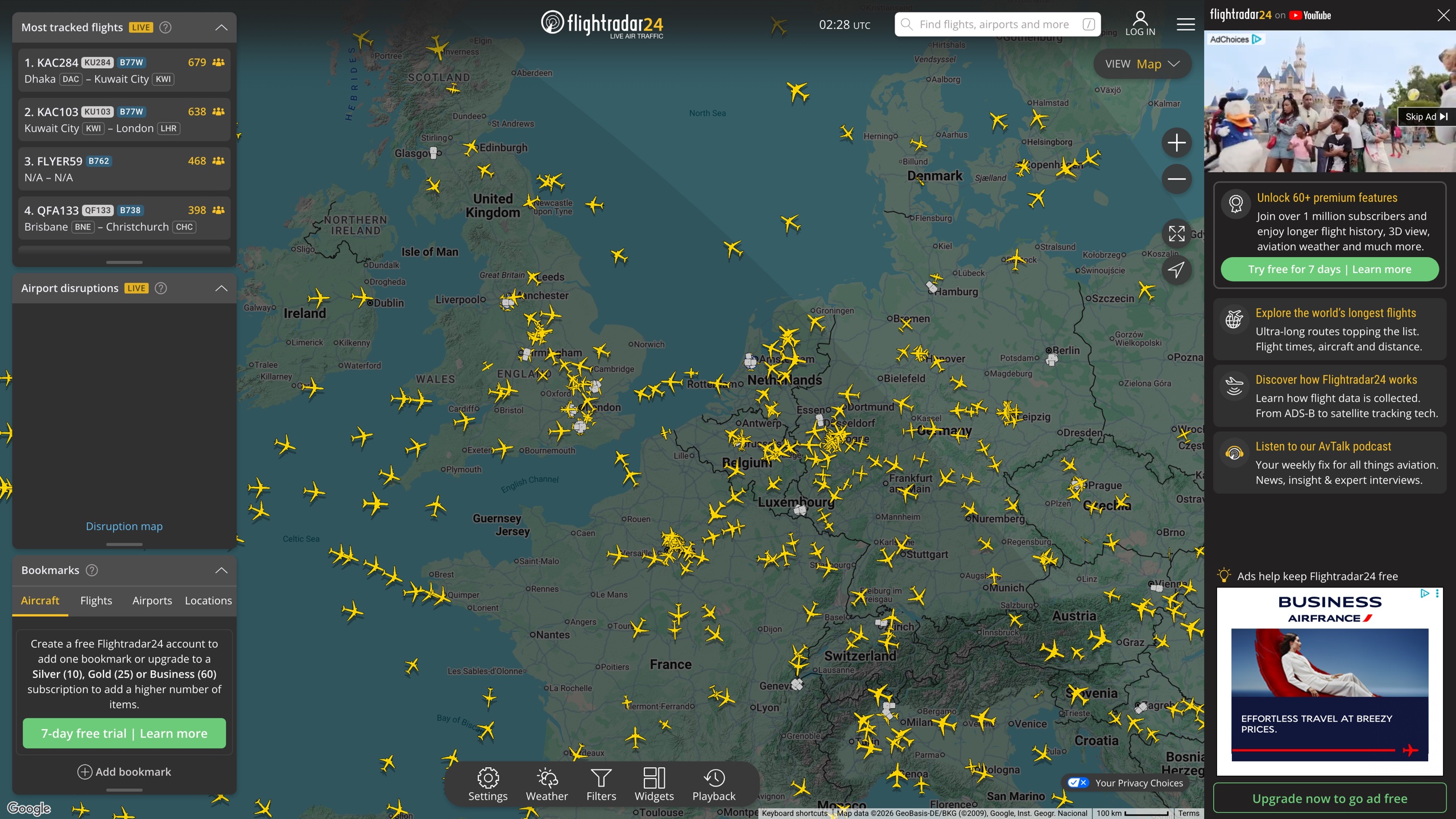
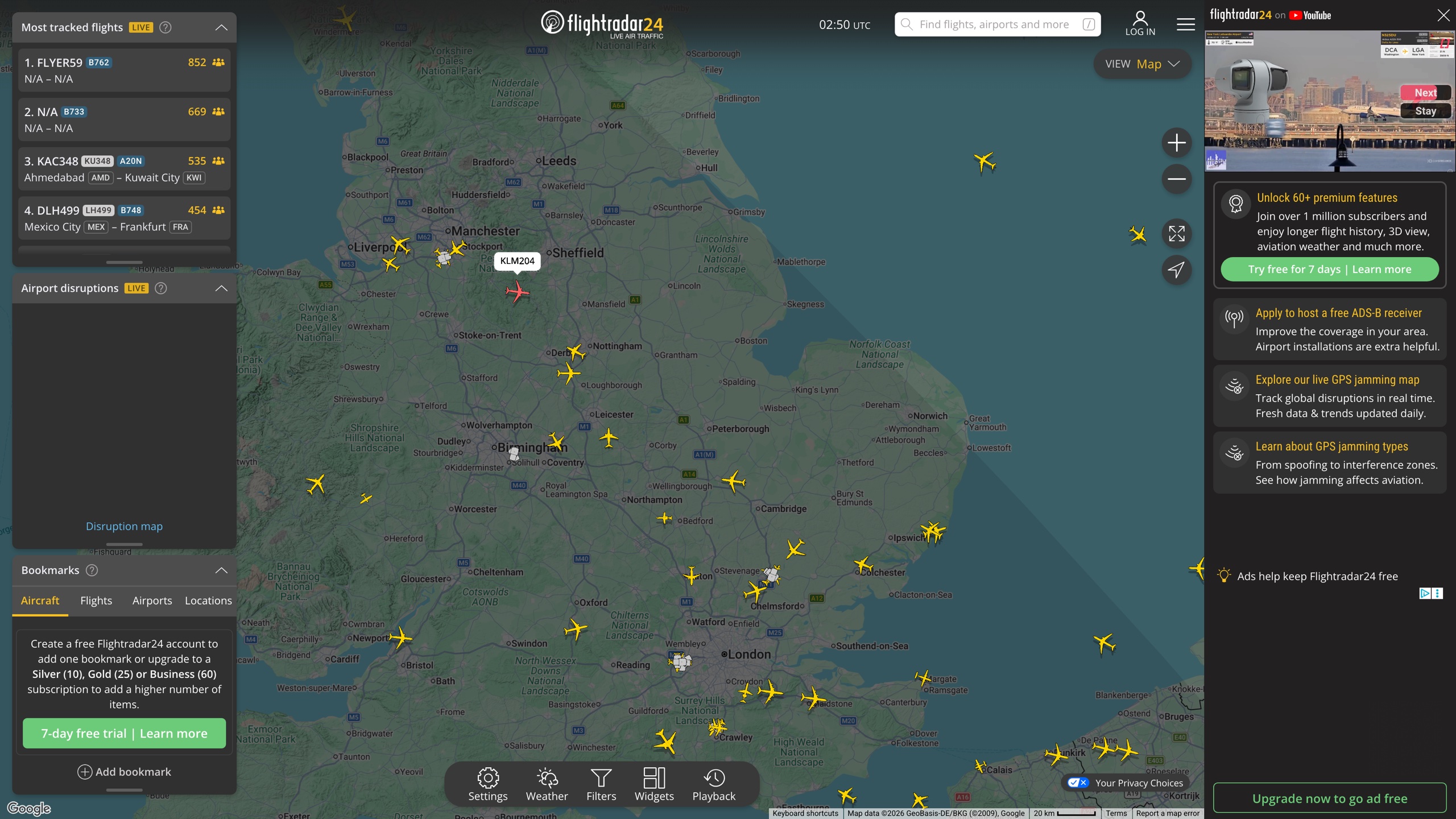
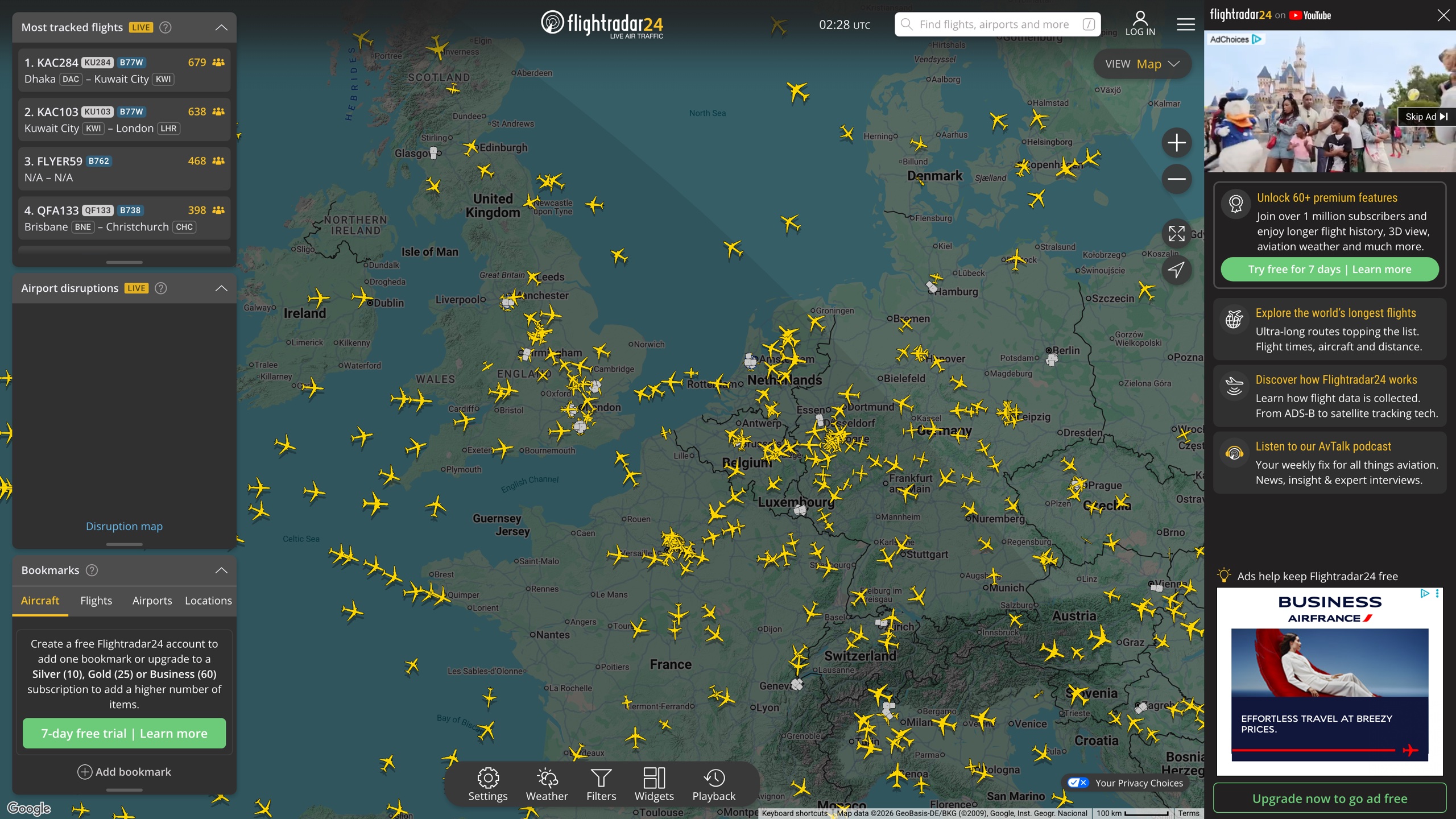
The homepage is the map — no sign-in needed. The default view sits over Europe with yellow aircraft icons moving live. The left rail shows a "Most tracked flights" leaderboard and airport disruption alerts; the right rail carries ads and feature promos (the free tier is ad-supported; subscriptions remove them). A bottom toolbar offers settings, weather layers, filters, widgets, and playback.
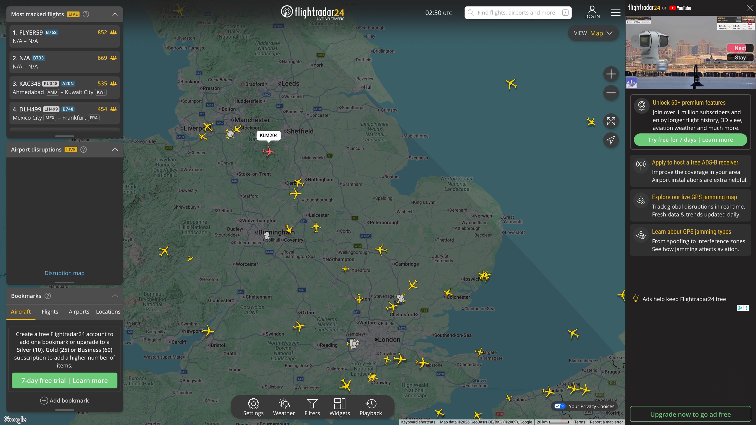
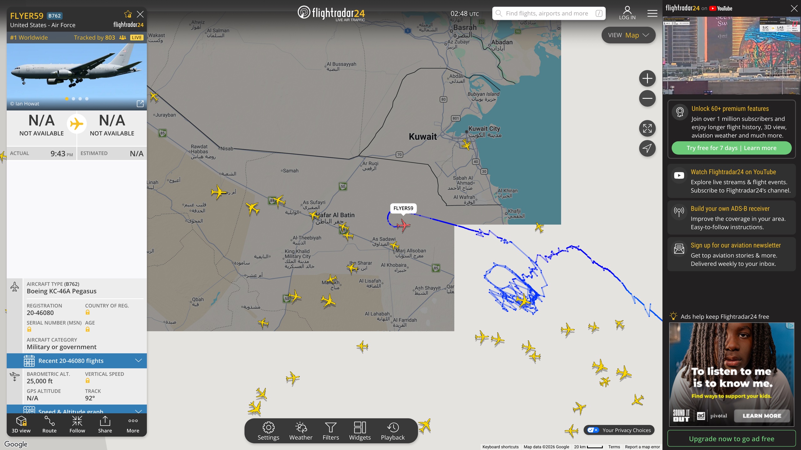
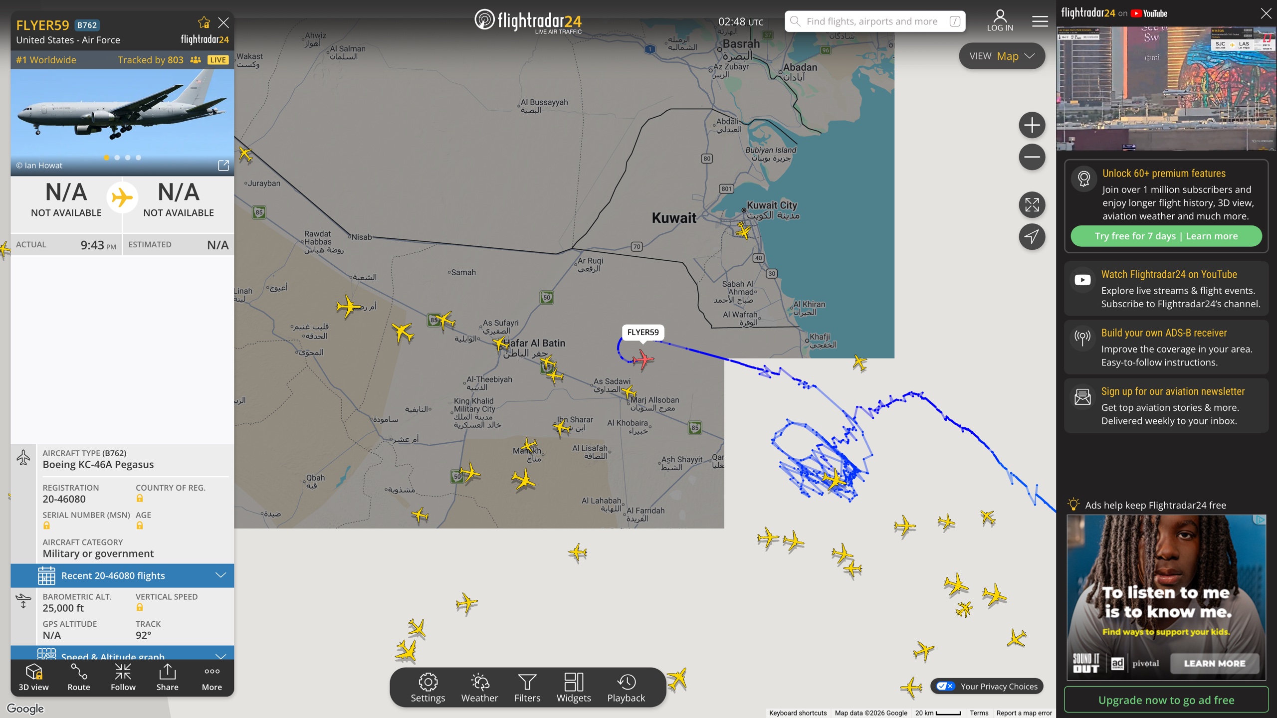
Zoomed in, aircraft are denser and hovering reveals callsigns. Clicking a plane opens a detail panel: route and ETA, aircraft type, registration, serial number and age, altitude/speed/track, and JetPhotos photos of the actual airframe. Military and certain special flights may show no route. The screenshot below, captured 2026-09-02, shows a US Air Force KC-46A tanker (callsign FLYER59) — the most-tracked aircraft worldwide at that moment, yet with origin and destination listed as N/A. That is the blocking policy discussed below in action.
Beyond the website, there are iOS and Android apps (US App Store rating 4.8 with ~656K ratings, version 11.10.0 as of 2026-09-02) plus Apple Watch and Wear OS support; the site itself recommends the app for the full mobile experience. The app adds an AR mode that identifies aircraft by pointing your phone at the sky.
Pricing and Subscriptions
The free tier covers the core without an account: live map, flight details, airport arrival/departure boards, limited historical playback, and a small number of 3D-view sessions — in exchange for ads. Paid tiers at US App Store in-app prices (as of 2026-09-02; the company notes prices vary by country and currency, so in-app or on-site display is authoritative):
- Silver: 12.99/year. 90 days of flight history, extra aircraft and flight details (serial number, age, vertical speed, squawk), filters and alerts, and current weather at 3,000+ airports;
- Gold: 34.99/year. Everything in Silver, 365 days of history, live cloud and precipitation layers, aeronautical charts and oceanic tracks, ATC boundaries, and extended Mode S data;
- Business: aimed at commercial use, with up to 3 years of history and higher filter/alert limits, sold only on the website (the official support article notes it is not available through the App Store). As of 2026-09-02 we could not verify its current USD list price from official pages (the pricing page localizes dynamically and is behind bot protection); third-party records from 2023 listed $499.99/year, for reference only.
All paid tiers include a 7-day free trial. Users who feed ADS-B data to the network can receive an invitation-only Contributor plan with premium features free; the developer-facing Flightradar24 API is billed separately and not included in these subscriptions.
Blocking and Privacy Policy
Not every aircraft is visible. The official How it works page and a support article (updated July 2026) state: a small number of flights are limited or blocked at the request of owners or operators via third-party services, including the FAA's LADD (Limiting Aircraft Data Displayed) program — established under Section 803 of the 2024 US FAA Reauthorization Act, which lets private owners request that registration and other identifying data be withheld (FAA LADD page). High-profile aircraft such as Air Force One are not displayed; military and government aircraft may be blocked entirely; other restricted aircraft appear anonymized by type without identifying details. In practice (observed 2026-09-02), many military aircraft remain visible — like the KC-46A above — with route information withheld.
Note that LADD binds only platforms that use FAA data and choose to comply; community networks such as ADS-B Exchange do not filter, so blocked aircraft may still be visible there (discussion). For readers, this means Flightradar24's map is the compliance-filtered view of the sky.
Good Use Cases
- Checking a flight's live position, ETA, and inbound aircraft before heading to the airport;
- Identifying a plane you just saw overhead;
- Aviation enthusiasts exploring fleets, trails, and airport operations; journalists and researchers verifying events (its data is used by the aviation industry and accident-investigation agencies, per the careers page);
- Radio hobbyists applying for a free receiver and trading data for premium features.
Limitations
- Coverage gaps: oceans and remote areas depend on satellite fill-in; low-flying small aircraft and non-ADS-B types are invisible outside MLAT coverage; the company states coverage can change at any time.
- Deliberately hidden aircraft: see the blocking policy above — the map is not a complete air picture.
- Ad-heavy free tier: as of 2026-09-02 the website's right rail carries video and display ads, and free 3D-view sessions are limited.
- "Entertainment purposes" disclaimer: the US App Store description restricts use of the data to entertainment; cross-check anything that matters (like pickup times) against airline or airport sources.
- English-only website: non-English readers need browser translation or the localized app.
- Prices float by region and platform: there is no fixed USD price list on the website, and App Store versus web prices may differ.
Alternatives
FlightAware is the closest commercial peer: also a free map plus tiered subscriptions, with stronger US flight-operations data and enterprise feeds (see SkyLink API's 2026 comparison). For unfiltered raw ADS-B data, the community-run ADS-B Exchange takes the opposite approach to blocking — at the cost of a far less polished product.
References
- Flightradar24 official site and How it works (visited 2026-09-02; content checked against a 2026-02 archive)
- Company description on the careers site (checked 2026-09-02)
- Flightradar24 | Flight Tracker - App Store and Google Play (prices, languages, Wear OS, version checked 2026-09-02)
- Support: why some aircraft information is limited or not visible and how to upgrade a subscription
- FAA: Limiting Aircraft Data Displayed (LADD)
- Wikipedia: Flightradar24 (cross-check for history and company data)